
New Leica Aibot UAV facilitates more accurate, safer aerial surveys

By MEq
Related Articles
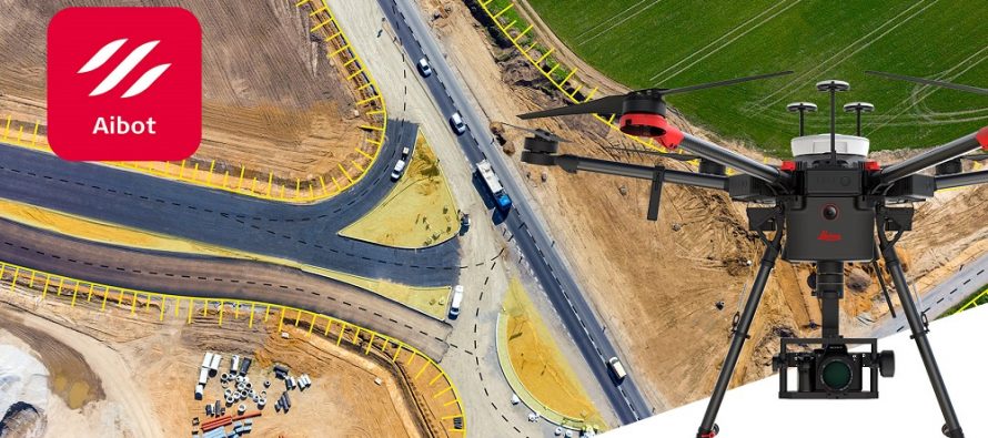
Leica Geosystems, part of Hexagon, industry leader in measurement technology, has announced the new Leica Aibot, the latest Unmanned Aerial Vehicle (UAV) system based on DJI’s aerial platform, the M600 Pro, to rapidly and autonomously enable digitizing of critical infrastructure.
The new Leica Geosystems UAV technology allows users to get a complete data set in less time with a user-friendly and innovative interface, opening new business opportunities while spending less time, costs and effort than with traditional methods. Leica Geosystems software suite supports the new UAV workflows. Using Leica Infinity for point cloud, digital surface model and orthophoto generation enables surveyors to easily process and visualize aerial data to maximize productivity and speed-up data delivery. Supporting users to share data to Cylcone and Cloudworx, the integration of the UAV point cloud with terrestrial scan data enables users to make the most informed decisions. This complete set of data results in higher project efficiency.
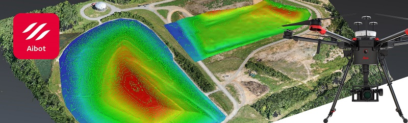
 The new UAV technology, developed in partnership with DJI, the world’s leading manufacturer of UAVs allows users to process and analyze millions of data points gathered from above and visualize the data to provide actionable information. UAV data can be combined with existing survey technologies, such as TPS, GPS and laser scanning, providing a more complete set of information.
Throughout a project lifecycle of planning, designing and construction, Aibot provides easier access to critical information to perform volume calculations and monitor site progress. From creating digital terrain models to stripping and bulk earthworks and trenching to finally fine grading, paving and compaction, the solution supports easier actuals comparisons. This provides a more transparent view of site progression monitoring and volume calculations with safer operations to keep projects on schedule.
The Aibot can identify gaps early with a level of accuracy previously unknown for the construction industry. High definition imagery and 3D mapping allow for the viewing of site mapping or progress documentation, meaning users save time and money at all stages of the project.
By MEq
Follow & like us


Most Popular Posts


